

New Orleans is sinking – not metaphorically, not slowly in some abstract geological sense that won’t matter for a thousand years. It’s sinking right NOW.
The changes are measurable, rapid, and the math is not kind.
A peer-reviewed study published in Nature Sustainability recently made headlines by calling New Orleans “America’s coastal ground zero” and arguing, with unusual bluntness for an academic paper, that managed relocation of the city’s roughly 360,000 residents needs to start immediately. Not eventually – but starting now and managing the inevitable instead of reacting.
That’s a striking thing to say about one of the most culturally rich cities in the United States. One of my colleagues used to live in New Orleans so I had the good fortune over the years and enjoying New Orleans both for the Jazz Festival and Mardi Gras, Creole cooking – which was different than anything I have ever tasted before – and centuries of layered history however is not anything that the rising water levels care about and becoming increasingly dangerous.
Contents
- 1 Why New Orleans Is Sinking Into the Ground
- 2 The Sea Level Rise Picture Is Actually Worse Than We Thought
- 3 What the “Point of No Return” Study Actually Says
- 4 Hurricanes, Climate Change, and the Multiplier Effect
- 5 The Political Problem Nobody Wants to Talk About
- 6 Managed Retreat: The Only Real Option
- 7 Frequently Asked Questions About New Orleans Sinking and Sea Level Rise
- 7.1 Why is New Orleans sinking so fast?
- 7.2 How far below sea level is New Orleans already?
- 7.3 What does the Nature Sustainability study say will happen to New Orleans?
- 7.4 Is global sea level rise worse than previously reported?
- 7.5 Could better levees save New Orleans long term?
- 7.6 What is managed retreat and why are scientists calling for it?
- 7.7 Are other Gulf Coast cities facing similar risks?
- 7.8 Share this:
- 7.9 Related Post
Why New Orleans Is Sinking Into the Ground
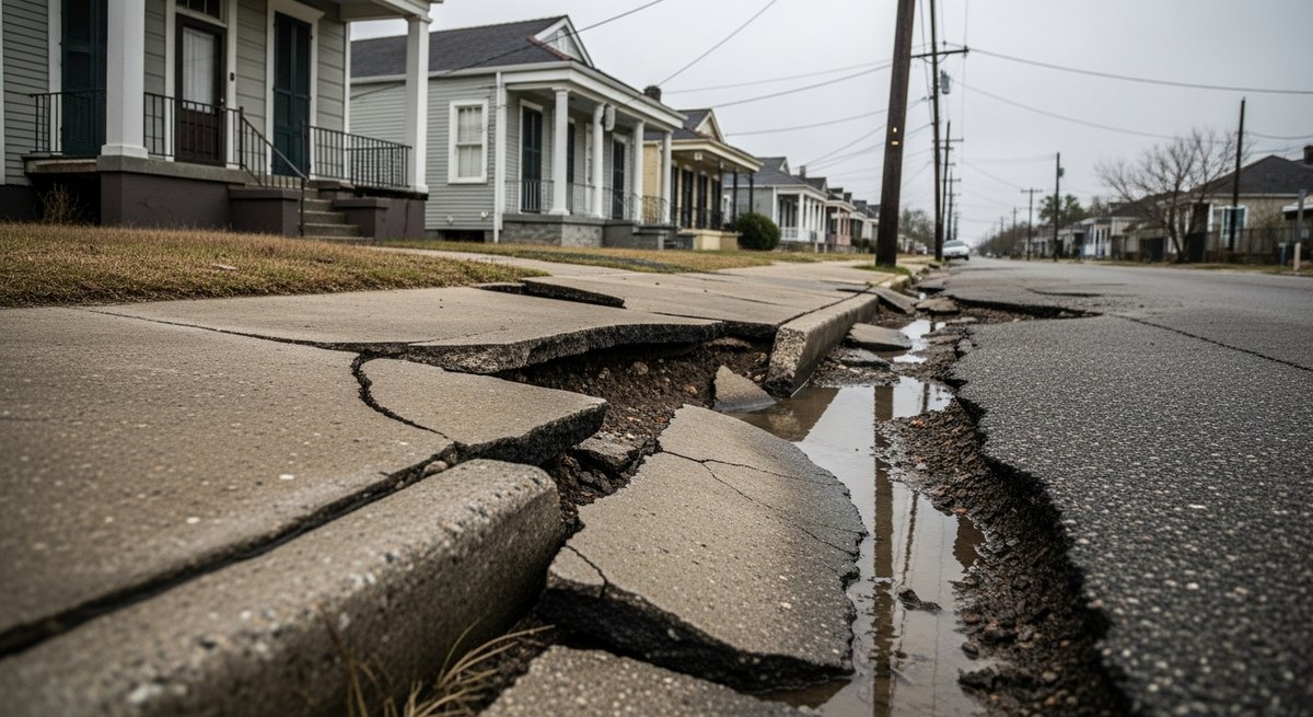
The problem with New Orleans isn’t just one thing. It’s a stack of compounding disasters, each one making the others worse. Climate scientist Paul Beckwith describes it as a “confluence of factors” that make the city’s situation uniquely dire, even among the many coastal cities facing sea level rise globally.
First, there’s land subsidence due to the fact that New Orleans sits in a bowl-shaped basin, and much of the city is already below sea level. The land itself is actively sinking – a separate and additional problem on top of rising seas. This sinking is driven partly by natural compaction of soft sedimentary soils, but it’s been significantly accelerated by oil and gas extraction. When you pump hydrocarbons out of underground reservoirs, you remove material that was structurally supporting the land above. The ground settles – and in Louisiana’s case, it’s been settling for decades.
Since the 1930s, Louisiana has lost over 2,000 square miles of coastal land. Another 3,000 square miles is projected to disappear within the next 50 years. At current rates, the state is losing a football-field-sized chunk of land every 100 minutes.
Then there’s the wetlands problem. Coastal wetlands act as natural buffers, absorbing storm surge and protecting inland areas. But the Mississippi River has been straightjacketed by levees that push its sediment-rich water straight into the Gulf rather than letting it rebuild marshland naturally. Without that constant sediment replenishment, the wetlands erode – and as they shrink, the land behind them becomes exponentially more exposed.
The Sea Level Rise Picture Is Actually Worse Than We Thought
A recent study reviewing 385 pieces of peer-reviewed scientific literature published between 2009 and 2025 found that global sea level rise has been systematically underestimated. Average global sea levels are actually around 30 centimeters higher than previously modeled. In parts of Southeast Asia and the Indo-Pacific, the underestimate runs between 100 and 150 centimeters – up to five feet more than we thought.
Why the discrepancy? Most sea level studies relied on land elevation data referenced against global geoid models rather than direct local measurements. Those models work reasonably well in the North Atlantic but are significantly less accurate elsewhere, missing local influences like ocean currents, wind patterns, and temperature and salinity variations.
The practical implication: if sea levels rise by just one meter above today’s baseline, accurate measurements suggest 37 percent more coastal area will be inundated than current models predict, affecting an additional 132 million people worldwide. Tracking how satellites are being deployed to improve environmental monitoring – as seen in efforts like the satellite hunt for superpollutants – shows just how critical better measurement infrastructure is becoming for understanding climate threats in real time.
What the “Point of No Return” Study Actually Says
The Nature Sustainability paper examined present-day warming conditions and compared them to sea levels during the Eemian interglacial period, roughly 125,000 years ago, when global temperatures were similarly elevated. Sea levels during the Eemian were dramatically higher than today, and that’s essentially where we’re heading again – the ocean doesn’t respond instantly to atmospheric warming. It commits to a level, then catches up over decades and centuries.
Using digital elevation maps, satellite radar measurements, and archaeological evidence, the study concluded that southern Louisiana faces between 3 and 7 meters of sea level rise. At 3 meters, New Orleans becomes an isolated island surrounded by water. At 7 meters, most of southern Louisiana, including areas around Baton Rouge, is submerged, and the shoreline migrates as much as 100 kilometers inland.
Beckwith puts it starkly: “If you look at this in paleoclimate terms, New Orleans is gone already. The question is how long it has.” The research authors use the word “terminal” and argue that the honest, ethical thing to do is to deliver that diagnosis publicly and start planning managed relocation instead of pouring money into infrastructure that can only delay the inevitable. As coastlines change, protecting them intersects with broader international efforts to preserve coastal and ocean ecosystems, though local policy action remains the most urgent need.
Hurricanes, Climate Change, and the Multiplier Effect
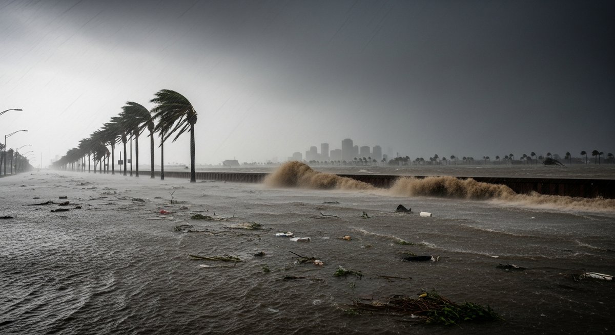
Overlaid on land subsidence and sea level rise is the intensifying hurricane threat. As ocean surface temperatures climb, hurricanes draw more energy from the water. They’re getting stronger. And a stronger hurricane hitting a city already below sea level, whose wetland buffers have been eaten away, is not the same event as a hurricane hitting that city 50 years ago.
Katrina was catastrophic. Future storms will have even more to work with. Storm surge from major hurricanes can already overwhelm levee systems. With 3 to 7 meters of additional relative sea level rise baked in, the baseline from which those surges launch keeps creeping upward. Warmer poles also reduce the temperature differential that keeps the jet stream tight, producing a wavier, slower jet stream where weather systems – including hurricanes – linger longer over the same areas. New Orleans already knows what that looks like.
The Political Problem Nobody Wants to Talk About
The peer-reviewed literature is clear as are the measurements. The obstacle (as usual) is political will – specifically the near-total absence of it when it comes to telling constituents that a city they love is going to have to be abandoned.
The study’s authors acknowledge this openly. Politicians discuss it in private, they said, but never in public. No elected official wants to be the one who says “New Orleans is terminal.” And so the conversation doesn’t happen at the scale it needs to, and time keeps passing.
The cancellation of the Mid-Barataria Sediment Diversion Project illustrates this perfectly. Funded by BP’s Deepwater Horizon settlement – a $3 billion project designed to redirect Mississippi sediment back into Louisiana’s coastal wetlands – it was scrapped over concerns about cost and fishing industry impacts. The irony: the fishing industry will have to relocate regardless as wetland erosion continues. Proponents called the cancellation “disastrous.” Meanwhile, legal efforts to force oil and gas companies to pay for coastal damage their extraction caused have been stalled or undermined. This makes investments in clean alternatives – explored in discussions about how cheap renewable energy is finally flattening emissions – feel all the more urgent.
Managed Retreat: The Only Real Option
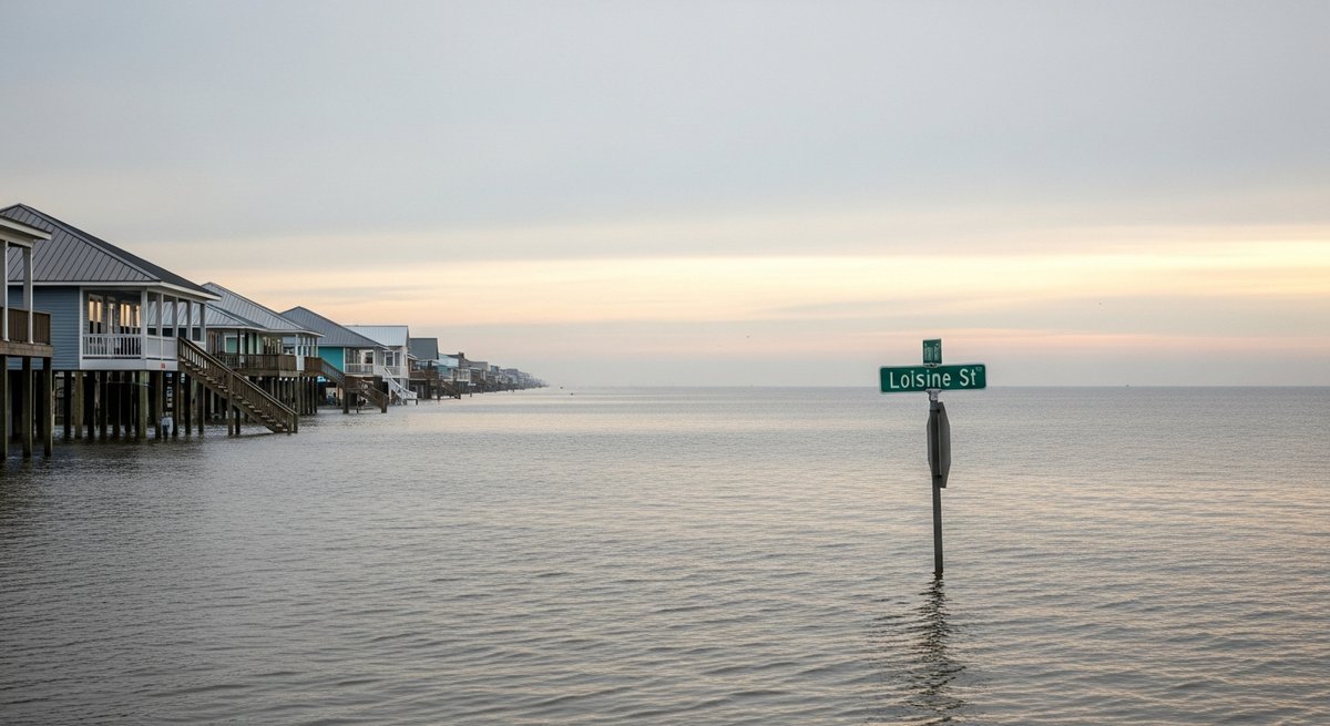
The study’s recommendation is managed retreat: a coordinated, government-supported process of helping people relocate from the most vulnerable areas to safer, higher ground. The researchers specifically mention communities already living outside the levee protection system as the most immediately at risk and the most logical starting point.
Managed retreat has been used in flood-prone riverine communities in the US Midwest and coastal areas of other countries. But it’s never been attempted at the scale New Orleans represents, and it’s never been politically popular. Nobody wants to leave their home.
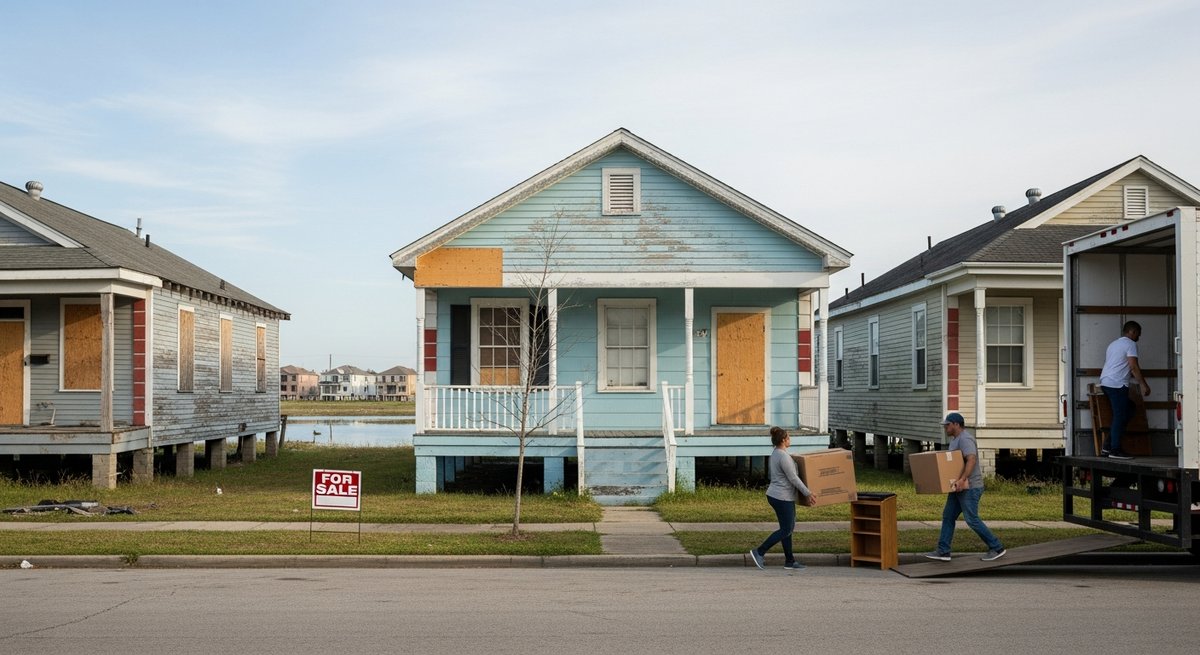
The alternative is what the researchers call “disorderly depopulation” – chaotic, unplanned flight as conditions become intolerable, without support systems or economic transition planning. That’s what Katrina previewed. Many people who left didn’t come back, and they didn’t leave on their own terms. Scaling that up over decades without intervention produces a humanitarian crisis layered on top of an environmental one. The population of New Orleans has already been declining. That trend will accelerate. The only question is whether it happens on terms that protect people or on terms that abandon them.
Frequently Asked Questions About New Orleans Sinking and Sea Level Rise
Why is New Orleans sinking so fast?
New Orleans is experiencing land subsidence from multiple causes working simultaneously: soft, compressible sedimentary soils compacting under urban infrastructure; oil and gas extraction removing underground material and causing ground settlement; loss of coastal wetlands removing natural land-building processes; and levees preventing Mississippi sediment from replenishing coastal marshes.
How far below sea level is New Orleans already?
Much of New Orleans sits between 1 and 3 meters below sea level, with some areas even deeper. The city essentially sits in a bowl, which is why hurricane storm surges are so devastating and why the levee and pump system requires continuous operation just to keep the city dry under normal conditions.
What does the Nature Sustainability study say will happen to New Orleans?
The study concludes that southern Louisiana faces between 3 and 7 meters of relative sea level rise, which would isolate New Orleans as an island at the lower end, submerge most of southern Louisiana at the higher end, push the coastline 100 kilometers inland, and eliminate three-quarters of Louisiana’s remaining coastal wetlands. The authors argue the city has reached a “point of no return” and that managed relocation must begin immediately.
Is global sea level rise worse than previously reported?
Yes, according to a comprehensive study reviewing 385 peer-reviewed papers from 2009 to 2025. Global average sea levels are approximately 30 centimeters higher than previously modeled, and in parts of Southeast Asia and the Indo-Pacific, the gap is between 100 and 150 centimeters. The discrepancy arises from over-reliance on geoid computational models rather than direct local measurements.
Could better levees save New Orleans long term?
No, according to the researchers and broader scientific consensus. The post-Katrina levee system has provided meaningful short-term protection, but it requires constant upgrades just to keep pace with worsening conditions. Maintaining a city below sea level on sinking land surrounded by rising water is not a permanent solution – it’s a delay. No infrastructure investment can save New Orleans indefinitely.
What is managed retreat and why are scientists calling for it?
Managed retreat is a coordinated, planned process of relocating populations from areas no longer safely habitable due to environmental risk. Scientists call for it because unplanned departure is far more damaging than organized relocation, starting early allows economic transition and cultural preservation, communities outside existing levees are already at extreme risk, and delay increases the scale and cost of eventual relocation while reducing available options.
Are other Gulf Coast cities facing similar risks?
Yes. New Orleans is the most extreme case, but cities and communities along the Gulf Coast face combinations of land subsidence, wetland loss, and sea level rise. The same Nature Sustainability study examined parts of Mississippi, Alabama, and Florida – all of which show significant population growth precisely in the coastal zones most exposed to future inundation.
Reference: https://www.youtube.com/watch?v=gmFtSupELcw

Dr. Alexander Tabibi is an entrepreneur, investor, and advocate for sustainable innovation with a deep commitment to leveraging technology for environmental and social good. As a thought leader at the intersection of business and sustainability, Dr. Tabibi brings a strategic vision to Green.org, helping guide its mission to inspire global climate awareness and actionable change.
With a background in both medicine and business, Dr. Tabibi combines analytical rigor with entrepreneurial insight.